 |
|
NSN utilizes Multi-Channel Analysis of Surface Waves in a wide variety of geologic investigations in order to examine subsurface soil densities and stratigraphic variability. MASW is a seismic method utilizing an array of geophones to record surface waves either as a result of an active controlled source, or natural and man-made background sources. The frequency and phase velocity of these waves is used to determine the shear-wave velocities of the underlying earth. Each individual array of geophone locations yields a 1-dimensional profile of shear wave velocity and density. MASW is useful in determining depths and thicknesses of soil or rock formations, determining depths of fill, and locating low density zones which are commonly associated with sinkhole activity. Applications of MASW include: |
- Geotechnical Investigations
- Subsidence Investigations
- Soil stability analysis
- Sinkhole identification and characterization
- Calculating earthquake liquefaction potential
- Landslide potential
- General classification of stratigraphic units and subsurface densities
NSN has utilized MASW throughout the United States as well as in the Caribbean and Central America on a wide variety of projects. It is a geophysical tool that can provide invaluable information to geotechnical engineers during the pre-development, site assessment period of a specific project. Similar to MER, this seismic method is a rapid and non-invasive approach to understanding the geology of a particular site. Additionally, it is unaffected by the presence of buried metal objects or changes in conductivity that can interfere with resistivity measurements. For this reason, NSN often uses MASW in conjunction with MER surveys to verify anomalous geologic features that appear in a particular data set. This approach has allowed us to utilize MASW for detecting subsurface voids and raveling soils, calculating the depth to the surface of a bedrock unit, analyzing the integrity of bedrock, and providing geotechnical engineers with quantified data regarding soil densities. Our geophysical surveys are generally followed by more traditional drilling approaches to confirm anomalous features recorded in the MASW profile, as well as to ground-truth the interpretations that are being made.
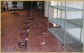
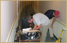
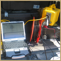
Examples of MASW Projects |